
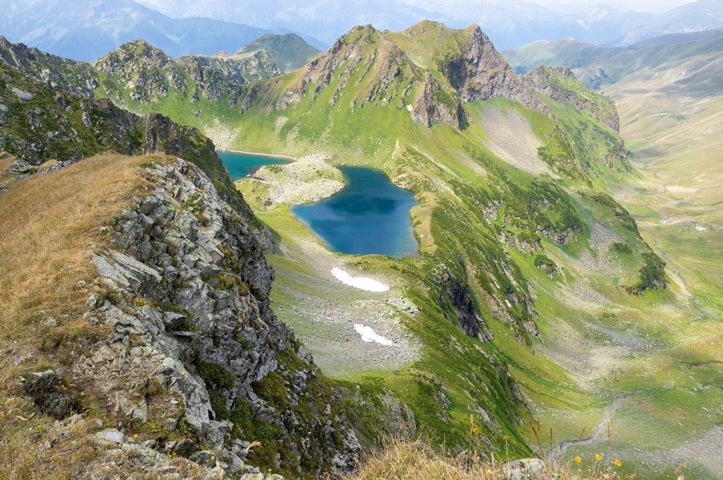
As mountain glaciers retreat, meltwater is collecting in lakes that grow larger and more numerous in valleys worldwide. Some form on the ice surface, some at the margin where the glacier ends and many sit behind dams of loose rock and debris left by the ice itself. These lakes are beautiful and scientifically valuable, recording the pace of ice loss in their rising shorelines, but they also create a hazard that mountain communities take seriously. A debris dam can fail, especially after heavy rain, an avalanche into the lake or an earthquake, releasing a flood that gathers speed and sediment as it rushes downstream towards villages, roads and hydropower plants. Monitoring programmes combine satellite watch, lake level sensors and field inspections to rank which lakes need engineering work, such as controlled lowering through siphons or channels. Local knowledge is indispensable, because residents notice changes in colour, level and debris that satellites may miss between passes. The lakes also create new ecosystems and water storage that some regions are learning to value, complicating a purely hazard based view. Managing them well means holding both truths at once, respecting the risk while understanding the changing mountain water system the lakes reveal.
What the Evidence Shows
Early warning systems are the most immediate protection, using sensors that detect a sudden lake drop or a flood wave high in the valley and trigger sirens and messages downstream with minutes to act. Drills with residents turn that technology into saved lives, since a warning only works if people know the sound, the route and the safe ground. Engineers, meanwhile, assess whether gradual lowering is feasible and safe, a decision balancing cost, access and the risk of disturbing an unstable dam. Research teams map older flood deposits to understand how large past events were, information that shapes land use planning on valley floors. Tourism adds pressure, as trekking routes pass many of these lakes and visitor numbers grow. With careful monitoring, honest risk communication and respect for local experience, growing glacier lakes can be studied and lived alongside more safely. Insurance and planning authorities are beginning to use lake inventories when assessing new construction below glaciers, a sign that scientific monitoring is translating into practical decisions about where building should be avoided. Reporting and analysis from sources such as National Science Foundation track the same developments, and specialists following growing glacier lakes monitoring say the direction is now consistent across independent lines of evidence.
The Wider Context
The wider context is a research landscape in which replication and open data now decide reputations. Findings connected to growing glacier lakes monitoring are being checked by independent groups with shared datasets, and the teams involved publish their methods in full so rivals can test every step. That discipline is slower than a headline cycle, but it is why results in this area increasingly survive first contact with scrutiny.
What Happens Next
What happens next in the story of growing glacier lakes monitoring will be decided by follow-up work already under way: larger samples, longer observation and instruments that have not yet come online. The researchers involved are unusually united on one point, that the current results justify the next investment of time and money. Readers will not have to wait long for the first tests of that claim. You can follow related developments in our coverage of science.
There is a practical lesson in all of this for readers deciding what to do today. Start with the verified facts, be wary of anyone promising certainty, and prefer reversible steps while the evidence is still developing. Circumstances differ by country, income and personal situation, so general guidance should always be weighed against your own context before you act on it in any significant or lasting way.
